Galveston vs. the Gulf
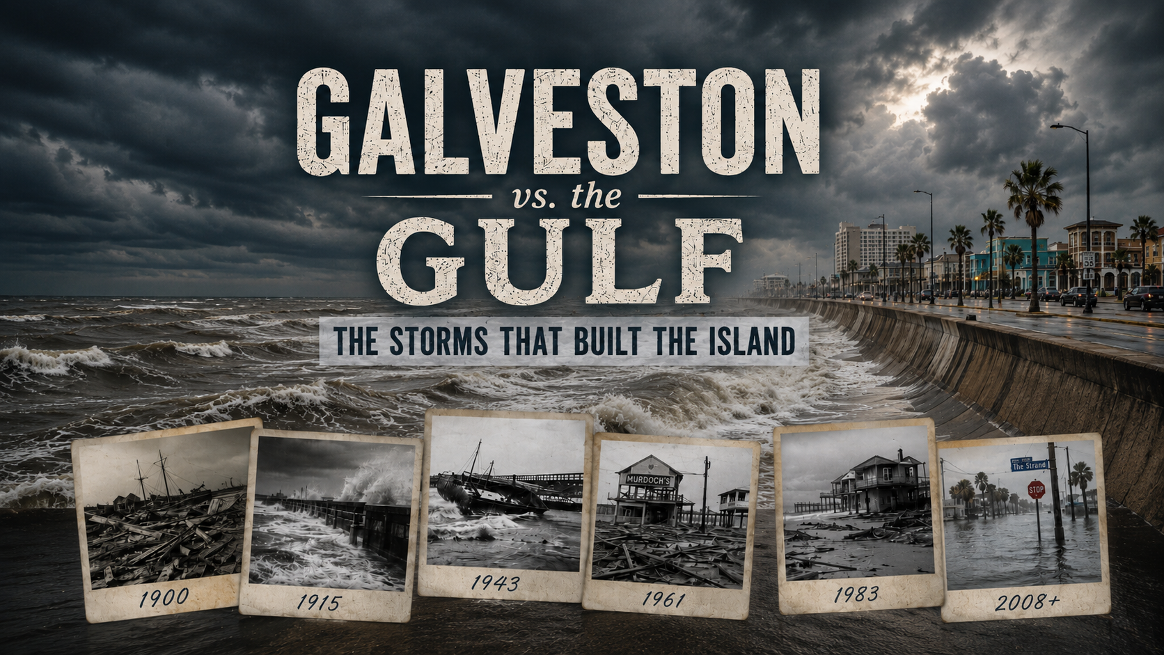
Galveston vs. the Gulf: The Storms That Built the Island
Galveston’s history cannot be separated from hurricanes. Storms destroyed the island, changed its economy, created the seawall, raised the city, reshaped its beaches, and forced generations of residents to rebuild.
Some storms became national tragedies. Others became strange pieces of local history. Every one left a lesson behind.
The Gulf keeps returning.
So does Galveston.
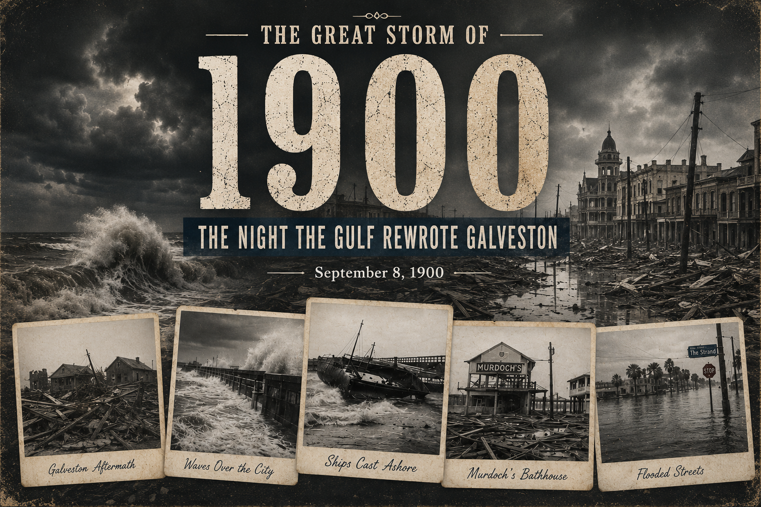
The Great Storm of 1900: The Night Galveston Changed Forever
Before the seawall, before hurricane tracking satellites, and before a weather app could send fourteen increasingly dramatic notifications about a cloud, Galveston stood almost completely exposed to the Gulf.
On September 8, 1900, a powerful hurricane struck the island. Galveston’s highest natural point sat only about 8.7 feet above sea level. The storm pushed an estimated 15-foot surge across the city.
There was nowhere for the water to go and almost nowhere for the people to escape.
Homes broke apart under the force of wind, waves, and floating debris. Entire neighborhoods disappeared. Telegraph lines failed, cutting the city off from the outside world. When the storm ended, much of Galveston had been destroyed.
At least 6,000 people died. Some estimates place the number closer to 8,000 or higher. It remains the deadliest natural disaster in United States history.
Those numbers can make the disaster feel distant. They should not.
Each number represented someone who had eaten breakfast that morning, checked on a neighbor, gone to work, cared for a child, or assumed the storm would pass like others had. Families climbed into attics. Residents crowded into stronger buildings. People fought through moving water filled with lumber, roofing, furniture, and pieces of houses.
Many never made it out.
The storm also changed Galveston’s future. Before 1900, the city had been one of the most important ports and commercial centers in Texas. After the disaster, business and investment increasingly shifted toward Houston.
Galveston did not disappear, though plenty of reasonable people might have looked at the wreckage and reconsidered the entire island experiment.
Instead, the city began one of the most ambitious engineering projects in American history.
Workers constructed a massive concrete seawall. Engineers then raised portions of the city by pumping sand beneath streets, utilities, and buildings. Hundreds of structures were lifted on jacks while the ground beneath them rose.
The Great Storm became part of Galveston’s identity, but survival became part of it too.
Today, the seawall attracts walkers, fishermen, cyclists, tourists, and locals holding drinks they probably should not carry while operating bicycles. Beneath all that ordinary island life stands a structure built because Galveston learned the worst possible lesson about the Gulf.
The island remembers September 8, 1900, not because the storm defeated Galveston, but because Galveston remained.
The city rebuilt on the same strip of sand, facing the same water, with considerably more concrete and a much healthier distrust of weather forecasts.
The 1915 Hurricane: The Storm That Put Galveston’s Seawall on Trial
Fifteen years after the Great Storm nearly erased Galveston, another major hurricane headed directly toward the island.
This time, Galveston had a wall.
The hurricane developed near the Cape Verde Islands in early August 1915. It crossed the Atlantic, struck parts of the Caribbean, and strengthened while moving through the Gulf of Mexico.
By the time it reached Texas on August 17, it carried winds estimated near 130 mph.
The storm was comparable in strength to the hurricane of 1900.
The result was not.
After the earlier disaster, Galveston had constructed a seawall and raised large portions of the city. The 1915 hurricane became the first true test of that enormous investment.
Waves slammed against the new barrier. Water poured into unprotected areas. Piers, rail lines, ships, and buildings suffered heavy damage. Communications failed, and thousands of residents crowded into sturdy public buildings.
The seawall held.
Only 11 deaths were reported within the city of Galveston, although hundreds died elsewhere along the storm’s path. Outside the seawall’s protection, destruction remained severe. Roughly 90 percent of the homes on exposed portions of Galveston Island were destroyed.
That contrast told the story.
The seawall could not stop a hurricane. It could not protect every part of the island. It could not prevent waves from destroying piers or water from flooding low areas.
It did, however, prevent Galveston from suffering another catastrophe on the scale of 1900.
The storm also proved that rebuilding had required more than stubbornness. Galveston’s leaders had changed the physical shape of the city. They had spent years moving buildings, raising streets, and constructing a barrier against the Gulf.
Then the Gulf returned to inspect the work.
It was not a gentle inspection.
The hurricane lasted longer than the 1900 Storm and caused extensive property damage. Residents lost homes, businesses, and boats. The Point Bolivar Lighthouse sheltered more than 50 people while surrounding structures were swept away.
Still, the center of Galveston survived.
Today, it is easy to treat the seawall as part of the scenery. It holds hotels, restaurants, souvenir shops, fishing spots, and one continuous parade of people trying to cross Seawall Boulevard without acknowledging the existence of traffic.
In 1915, the wall proved why it existed.
Galveston had taken the lesson of 1900, turned it into concrete, and placed it between the city and the Gulf.
Fifteen years later, that decision saved thousands of lives.
The 1943 Surprise Hurricane: The Storm Nobody Was Allowed to Talk About
In July 1943, Galveston and Houston were struck by a hurricane that arrived with almost no warning, limited official documentation, and the unfortunate timing of occurring during World War II.
The storm became known as the Surprise Hurricane, which sounds charming until one remembers that surprises involving 100 mph winds are generally terrible.
The system formed in the northern Gulf of Mexico and moved toward the Upper Texas Coast. Official records placed its sustained winds near 86 mph, although later researchers concluded that the damage suggested it may have reached Category 2 strength.
The storm was small.
It was also intensifying quickly.
On the morning of July 27, residents were told that a tropical storm of minor size and intensity was approaching. By the time stronger warnings arrived, Galveston and Bolivar were already taking hurricane-force winds.
The storm crossed the Bolivar Peninsula and Galveston Bay before moving directly through Houston. Gusts reached 104 mph in Texas City. Instruments recorded gusts of 132 mph at locations near Houston before the equipment failed.
Galveston’s seawall protected much of the Gulf-facing side of the city, but water from Galveston Bay flooded northern sections of the island. Power failed. Drinking water became scarce when pumps stopped working.
Across the channel, Point Bolivar suffered far greater destruction. Most homes were leveled. The Army Corps of Engineers dredge Galveston broke apart near the North Jetty, killing 11 crew members.
At least 19 people died across the region. Hundreds were injured. Damage reached approximately $17 million in 1943 dollars.
Then came the strangest part.
Because the country was at war, weather and damage information could be restricted for national security reasons. Officials feared that reports about damaged refineries, military facilities, and wartime production might aid enemy forces.
Warnings moved slowly. Reports were censored. Some records were classified or removed.
After the storm, the policy changed. Authorities recognized that keeping hurricane information secret presented a greater immediate danger to American lives than releasing it.
The storm also helped create hurricane-hunting history.
Colonel Joseph Duckworth and navigator Ralph O’Hair flew an AT-6 trainer into the hurricane after British pilots mocked the aircraft and questioned whether it could handle the storm.
Duckworth apparently responded to military teasing with the completely measured decision to fly directly into a hurricane.
They entered the eye and returned safely. The flight became an early foundation for organized aircraft reconnaissance of tropical cyclones.
The 1943 hurricane is less famous than Carla, Alicia, or Ike, but its legacy remains enormous.
It changed how storm warnings were handled. It helped demonstrate the value of aircraft reconnaissance. It also proved that a compact hurricane could reach the coast before the public understood what was coming.
Today, Galveston receives satellite loops, forecast cones, emergency alerts, television coverage, and phone notifications.
The people of 1943 received almost none of that.
They got a late warning and a hurricane already at the door.
Hurricane Carla: The Tornado, the Seawall, and the Second Death of Murdoch’s
Hurricane Carla did not make landfall in Galveston.
It did not need to.
Carla came ashore near Port O’Connor on September 11, 1961, as a Category 4 hurricane. It was enormous, powerful, and capable of affecting nearly the entire Texas coastline at once.
Hurricane-force gusts were recorded from Port Mansfield to Galveston. Galveston measured sustained winds near 88 mph. Storm surge reached an estimated 10 to 15 feet around Galveston Bay, while the Galveston airport collected more than 16 inches of rain over four days.
Then the tornadoes arrived.
Carla produced two tornadoes on Galveston Island. One became a violent F4 tornado that tore through part of the city, killing eight people, injuring roughly 200, and damaging or destroying around 200 buildings.
Hurricanes already contain wind, rain, surge, waves, and airborne patio furniture. Carla apparently reviewed that list and added a major tornado for completeness.
The storm also destroyed Murdoch’s Bathhouse.
Again.
Murdoch’s had occupied the Galveston beachfront in different forms since the late 1800s. The 1900 Storm destroyed the original structure. It was rebuilt, expanded, and became an island landmark.
Carla destroyed it a second time.
Historic footage shows huge waves striking the seawall near Murdoch’s while the Gulf battered the shoreline. The structure was later rebuilt again because Galveston businesses tend to treat destruction as an irritating permitting delay.
Carla’s greatest devastation occurred farther southwest. Port O’Connor and nearby coastal communities were nearly leveled. At the head of Lavaca Bay, the storm produced a water level near 22 feet, the highest hurricane surge measured in Texas history.
The storm flooded approximately 1.7 million acres of Texas land. Surge traveled as far as 10 miles inland in some locations.
Galveston’s seawall again reduced the damage. The island still endured major flooding, destructive winds, and tornadoes, but the wall prevented the Gulf from driving directly through central portions of the city.
Carla is often remembered for its size and strength. In Galveston, it should also be remembered for demonstrating how a storm can strike far down the coast and still cause deadly conditions on the island.
The center of a hurricane does not have to pass over Galveston for Galveston to be hit.
Carla arrived nearly 100 miles away.
The island still received hurricane-force gusts, deep water, more than a foot of rain, two tornadoes, and another opportunity to rebuild Murdoch’s.
Hurricane Alicia Arrived Fast, Left Glass Everywhere, and Stole 150 Feet of Beach
Hurricane Alicia did not spend weeks crossing the Atlantic while Texas watched colored forecast models argue with one another.
It formed close to home.
Alicia developed south of Louisiana on August 15, 1983. It drifted west, strengthened rapidly, and made landfall on the western end of Galveston Island during the early morning of August 18.
It arrived as a Category 3 hurricane.
Recorded sustained winds reached 96 mph, with gusts up to 127 mph. Water rose approximately 7.5 feet on the Gulf side of Galveston Island and about eight feet on the bay side.
Only about 10 percent of the population living behind the seawall evacuated.
That decision reflected confidence in the seawall, uncertainty about Alicia’s strength, and the ancient coastal tradition of assuming the storm will become somebody else’s problem.
Alicia made it Galveston’s problem.
The hurricane damaged homes, businesses, and utilities across the island. It also tore into the beaches. On West Beach, the public beach boundary moved landward by an average of about 150 feet. Storm surge removed as much as five feet of sand in some places.
Several houses suddenly stood seaward of the natural vegetation line, creating legal problems under the Texas Open Beaches Act.
Owners survived a hurricane and then discovered their houses had technically relocated onto the public beach.
The seawall protected central Galveston. The Army Corps of Engineers estimated that it prevented another $100 million in damage. Without the wall, Alicia could have driven destruction one or two blocks farther into the city.
The storm caused even greater wind damage in Houston. Gravel lifted from rooftops and smashed hundreds of windows in downtown skyscrapers. Streets filled with broken glass.
Alicia also produced 23 tornadoes across Texas, including 14 between Galveston and Houston during landfall.
Across the region, 21 people died. More than 3,000 were injured or became ill. Thousands of homes were destroyed or suffered major damage. Total losses reached approximately $2 billion, making Alicia the costliest hurricane in Texas history at the time.
Alicia remains a warning about storms that form close to the coast.
There was no long Atlantic journey. There was no two-week countdown. The system developed, intensified, and reached Galveston in roughly three days.
That gave residents little time to move from casual observation to actual preparation.
The Gulf does not always provide a lengthy introduction. Sometimes it develops a hurricane nearby, points it at the West End, and arrives before everyone has finished debating whether bottled water is really necessary.
Hurricane Ike Was “Only” a Category 2. Galveston Knows Why That Means Very Little.
Hurricane Ike made landfall on the eastern end of Galveston Island early on September 13, 2008.
Its sustained winds reached approximately 110 mph, placing it near the top of Category 2.
That category did not describe what the water was about to do.
Ike was an enormous hurricane. Its hurricane-force wind field was roughly four times the size of Hurricane Alicia’s. The storm’s broad circulation pushed a massive volume of Gulf water toward the Upper Texas Coast long before the center arrived.
Surge on Galveston Island reached an estimated 10 to 15 feet. Portions of the Bolivar Peninsula and eastern Galveston Bay experienced 15 to 20 feet.
Water crossed low sections of the island, flooded downtown buildings, and entered structures from the bay side. The Strand filled with water. Businesses, homes, schools, and public buildings suffered extensive damage.
Across Bolivar, entire neighborhoods disappeared.
The seawall protected much of central Galveston from the direct force of Gulf waves, but it could not seal the island. Water entered from the bay and through lower areas beyond the wall’s protection.
Ike also kept blowing.
Because of its size, tropical-storm and hurricane-force winds lasted for hours. In many places near the center, damaging winds persisted for at least nine hours. Trees, roofs, and utility systems endured a long assault rather than one brief period near the eye.
After the storm, residents returned to streets lined with debris. Waterlogged drywall, furniture, appliances, insulation, and personal belongings formed piles outside homes.
Recovery did not happen in a dramatic television montage.
It happened one ruined room at a time.
Families stripped houses down to framing. Workers cleared roads and restored utilities. Businesses cleaned mud and saltwater from buildings. Schools operated from damaged facilities. Residents waited through insurance claims, contractor shortages, and government paperwork because surviving the hurricane had apparently not been sufficiently exhausting.
Ike changed Galveston again.
It renewed demands for greater regional storm-surge protection. It changed construction decisions. It reminded a new generation that the hurricane category measures wind speed, not storm size, rainfall, or surge.
That distinction matters whenever someone calls a storm “only” a Category 1 or Category 2.
Ike was a Category 2 at landfall.
Its surge devastated communities, destroyed homes, and transformed thousands of lives.
Galveston does not remember Ike as a number.
It remembers the water.
Hurricane Nicholas: The Overnight Storm That Flooded the Strand and Killed the Power
Nicholas spent most of its approach looking like a tropical storm that would bring rain, wind, and inconvenience to the Texas coast.
Then it became a hurricane shortly before landfall.
Nicholas came ashore near Sargent Beach shortly after midnight on September 14, 2021, with winds near 75 mph. The center then moved slowly across the Houston-Galveston region.
At Galveston Bay, a weather station measured sustained winds of 54 mph with a gust to 68 mph. Across the broader region, rainfall generally reached four to nine inches, with more than 10 inches measured near Freeport.
The storm flooded streets, pushed water into portions of the Strand, and knocked out power across Galveston County.
Nicholas was not Ike. It was not Alicia. It was not the Great Storm.
That did not make it pleasant.
Trees fell. Signs broke. Roofs and siding peeled away from some buildings. Intersections flooded. Residents woke to dark houses, blocked streets, and the familiar discovery that every rechargeable flashlight in the home had somehow reached zero percent at the same time.
The storm highlighted one of the more exhausting features of Gulf Coast life.
A tropical system does not need to become a major hurricane to disrupt everything.
A minimal hurricane can still close roads, damage property, flood businesses, and leave families without electricity. It can also strengthen shortly before landfall, after many residents have already formed an opinion about how serious it will be.
Nicholas produced a few feet of surge around Freeport and Galveston Bay. Winds damaged trees and utility systems. Flooding affected roads throughout the coastal region.
Yet the storm also could have been worse.
Nicholas never developed the large, destructive surge of Ike. Its heaviest rainfall remained far below Harvey’s historic totals. No deaths were reported in Texas from the storm.
Not every named storm approaching Galveston becomes a catastrophe. Some weaken. Some shift. Some produce several hours of ugly weather and a morning spent dragging branches away from the driveway.
Preparation still matters because the outcome is not known in advance.
Nicholas strengthened into a hurricane late in the process. It reached the coast overnight. Its effects varied sharply across relatively short distances.
The lesson was not that every tropical storm should cause panic.
The lesson was that Gulf weather deserves attention until it is safely inland and becoming somebody else’s soggy problem.
Hurricane Beryl and the Myth of “Just a Category 1”
When Hurricane Beryl approached Texas in July 2024, it had already built an international reputation.
The storm had become a Category 5 hurricane in the Caribbean, weakened over land, and then entered the Gulf of Mexico. It made its final Texas landfall near Matagorda at approximately 4 a.m. on July 8 as a Category 1 hurricane with sustained winds near 80 mph.
People quickly attached the word “only” to the category.
Galveston received the correction.
A station in Galveston recorded a gust of 78 mph. The Galveston Causeway recorded a gust near 86 mph. A station at the Galveston Bay entrance recorded 82 mph.
Those winds were strong enough to damage roofs, topple trees, and knock out electricity. Across Southeast Texas, millions of customers lost power during oppressive summer heat.
Beryl also pushed significant water toward the island. Investigators later documented a high-water mark near the western end of Seawall Boulevard equivalent to approximately 6.3 feet above mean higher high water. Bolivar experienced several feet of surge inundation.
Galveston measured less rain than several inland locations, with about 2.6 inches recorded at the airport. That number did not make the storm harmless. Wind, surge, and prolonged power failure created separate dangers.
Beryl reinforced a lesson Galveston had already learned from Ike, Alicia, and Nicholas.
The category measures maximum sustained wind near the center. It does not provide a complete damage forecast.
It does not tell residents how large the wind field will become. It does not measure storm surge. It does not show which neighborhoods will flood. It does not predict how many trees will fall onto power lines or how long electricity will remain unavailable.
It certainly does not account for the misery of losing air conditioning in July.
Beryl crossed Southeast Texas quickly, but its effects continued long after the center moved inland. Residents cleared trees, repaired roofs, and waited for power restoration while temperatures climbed.
The storm also erased whatever comfort people had taken from the calendar.
Beryl struck Texas on July 8, well before the traditional peak of the Atlantic hurricane season. Galveston did not have to wait for late August or September.
That makes Beryl a useful storm to remember whenever an early-season system begins moving through the Gulf.
A Category 1 hurricane is the lowest hurricane category.
It is still a hurricane.
Galveston understands the difference, usually after the lights go out.
The Gulf Keeps Returning. So Does Galveston.
Galveston’s history is not simply a list of storms.
It is a history of what people did after them.
The island built a seawall after the 1900 Storm. It raised streets, homes, churches, and businesses. It watched the seawall survive the 1915 hurricane. It changed weather-warning policies after the Surprise Hurricane of 1943.
It rebuilt Murdoch’s after Carla. It repaired neighborhoods after Alicia. It cleared mountains of debris after Ike. It restored power after Nicholas and Beryl.
The names changed.
The routine did not.
Residents watched the Gulf. They boarded windows. They moved vehicles. They checked on neighbors. They argued over evacuation plans. They bought enough bottled water to survive the collapse of civilization and somehow forgot batteries.
Then they waited.
Some storms passed with little more than rain and rough surf. Others changed the island permanently.
Every storm left behind another reminder that Galveston is beautiful partly because it is vulnerable. The water that draws people to the island is the same water that has repeatedly threatened to take it apart.
That relationship has never been simple.
Galveston does not defeat hurricanes. No city does.
It prepares, survives, rebuilds, and remembers.
The Gulf keeps returning.
So does Galveston.